LANTA MAP INFO POCKET

Lanta Map Info Pocket
Lanta Map Info Pocket - Size

LANTA MAP INFO POCKET

LANTA MAP INFO POCKET is a compact folded map of Koh Lanta, created for tourists, residents and anyone who wants a clear printed guide to explore the island.

Easy to carry and simple to use, this pocket-size tourist map helps you find the main roads, beaches, viewpoints, temples, waterfalls, piers, hospitals, gas stations, supermarkets and other useful places around Koh Lanta.

Unlike free advertising maps, LANTA MAP INFO POCKET is designed to stay clean, practical and easy to read. It is 100% advertisement-free, with the full surface dedicated to useful travel information.

Printed in full color on both sides, it includes a detailed Koh Lanta road map, destination photos with location references, and essential island information.

A reliable printed map for exploring Koh Lanta with confidence.

BUY NOW

CHOOSE YOUR FAVORITE PLATFORM
Lazada Shopee

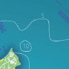
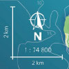
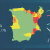
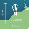
A detailed tourist map of Koh Lanta

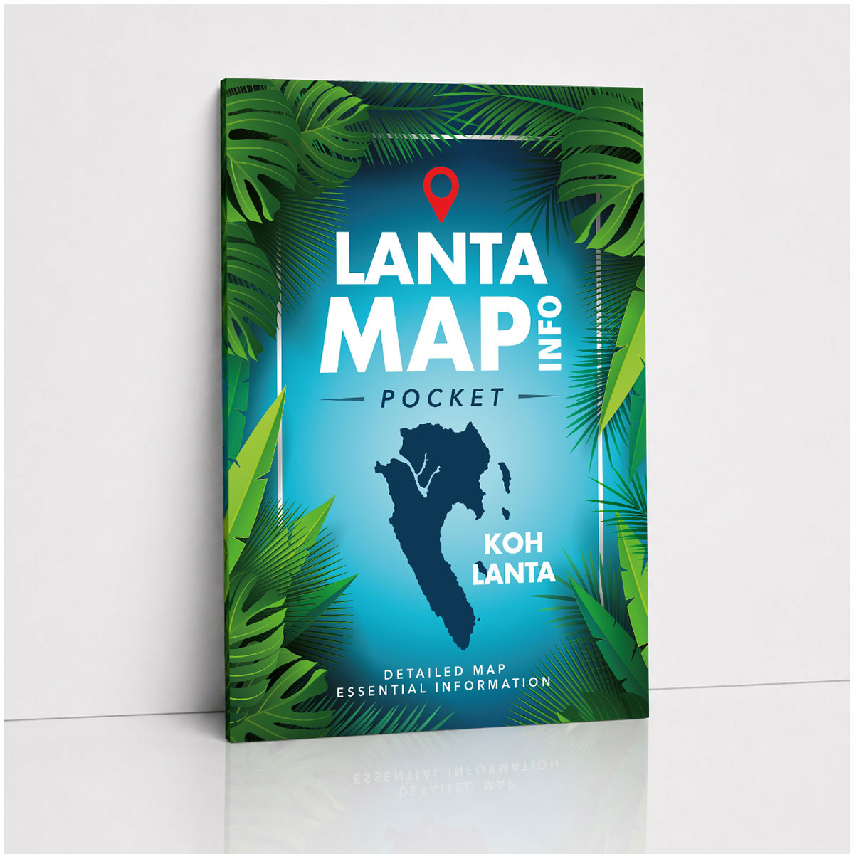
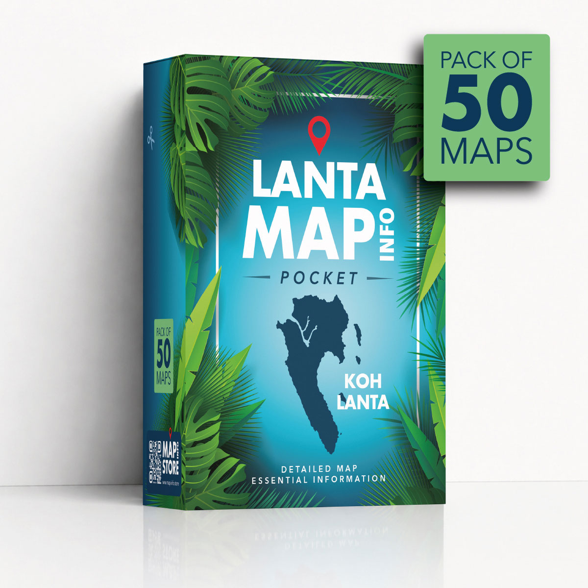
The LANTA MAP INFO POCKET is a compact and practical folded tourist map of Koh Lanta, designed for tourists, residents and anyone who wants a clear printed guide to the island. Easy to carry and simple to use, this detailed Koh Lanta map helps you explore the island with more confidence, whether you are visiting for a few days, staying for several weeks or living on the island.

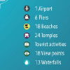
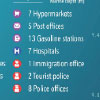
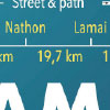
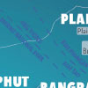
This folded map gives you a useful overview of Koh Lanta, including main roads, secondary roads, beaches, temples, viewpoints, waterfalls, piers, hospitals, gas stations, supermarkets and many other important locations. It is a practical travel companion for discovering the island, planning routes and understanding how the different areas of Koh Lanta are connected.

Explore beaches, viewpoints and places to visit

Koh Lanta is full of beaches, natural attractions, cultural places and scenic viewpoints. The LANTA MAP INFO POCKET helps you locate many of the island’s key points of interest on one clear printed map. You can use it to find famous beaches, discover quieter areas, identify roads around the island and better understand where the main tourist zones are located.

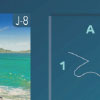
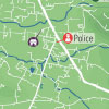
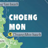
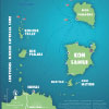
The map also includes a selection of destination photos with a location reference system. This makes it easier to connect real places with their position on the map and helps you choose where to go next while exploring Koh Lanta.

Useful information to better understand the island

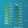
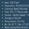
More than a simple road map, the LANTA MAP INFO POCKET also includes essential information to help users better understand Koh Lanta. It is designed to provide a clear and useful overview of the island, with practical details for orientation, travel and discovery.

Whether you are looking for beaches, transport points, useful services, tourist attractions or general island information, this printed Koh Lanta map gives you a convenient reference that you can keep with you during your stay or everyday life on the island.

Practical for tourists and residents

The LANTA MAP INFO POCKET is suitable for tourists visiting Koh Lanta, but also for residents who want a compact and reliable map of the island. It can be useful when driving a car, renting a scooter, taking a taxi, planning a day trip, meeting friends in a different area or simply checking where a place is located.

Its folded pocket format makes it easy to store in a bag, backpack, scooter compartment, car glove box or travel pouch. It is light, compact and convenient, while still offering a detailed view of Koh Lanta when unfolded.

100% advertisement-free map

Unlike many free tourist maps, the LANTA MAP INFO POCKET is completely advertisement-free. The full surface of the map is dedicated to useful travel information, making it cleaner, easier to read and more pleasant to use.

This clear and neutral design makes the map especially practical for people who want direct access to useful information without visual distractions. The result is a more professional and user-friendly printed map of Koh Lanta.

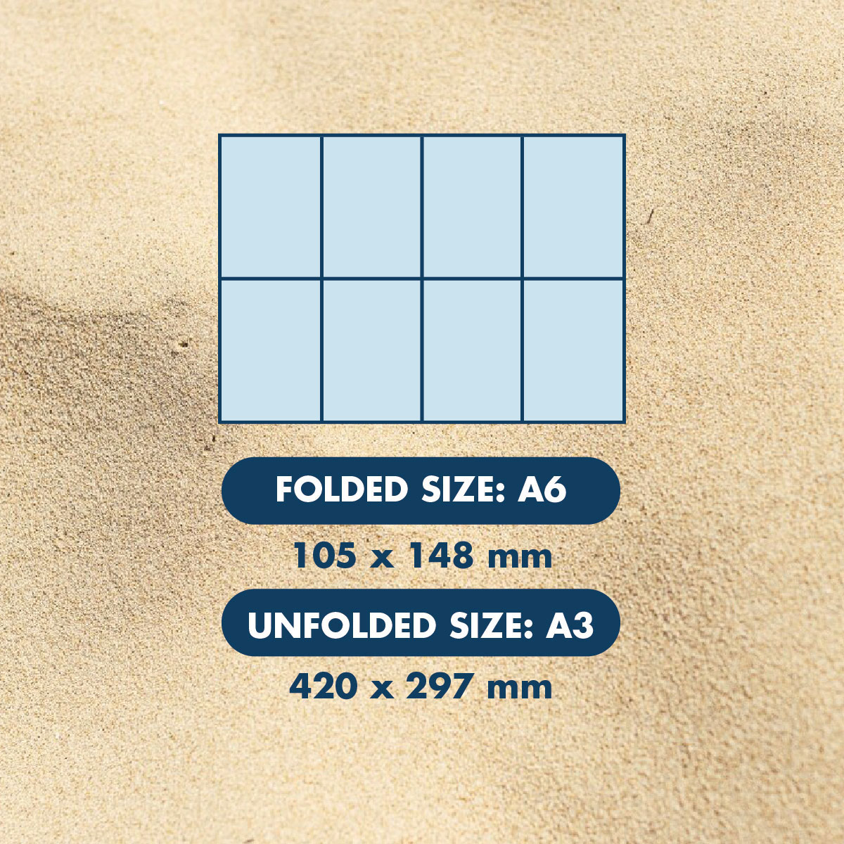
Compact folded A3 format

The LANTA MAP INFO POCKET is printed in full color on both sides in an A3 folded format. When opened, it provides enough space to display a detailed map and useful information, while remaining compact when folded.

This format is ideal for everyday use around Koh Lanta. It is large enough to be readable and detailed, but small enough to carry easily while traveling, exploring or moving around the island.

A reliable printed guide to Koh Lanta

Digital maps are useful, but a printed map remains a simple and reliable way to understand a destination. The LANTA MAP INFO POCKET gives you a visual overview of Koh Lanta that is easy to consult at any time. It helps you see the island as a whole, compare areas, plan routes and discover places you may not have noticed before.

For tourists, it is a practical travel map for exploring Koh Lanta. For residents, it is a useful reference map to keep at home, in the car or on the scooter. For anyone interested in the island, it is a clear and compact printed guide to one of Thailand’s most popular destinations.

Why choose LANTA MAP INFO POCKET ?

Choose the LANTA MAP INFO POCKET if you are looking for a detailed, compact and easy-to-use Koh Lanta tourist map. It combines practical road information, beaches, landmarks, tourist attractions, useful services, destination photos and essential island information in one folded printed map.

Clean, portable and advertisement-free, the LANTA MAP INFO POCKET is a simple but valuable companion for discovering Koh Lanta, planning your movements and keeping a better understanding of the island wherever you go.

MAP SIDE FEATURES

Detailed Koh Lanta map

Detailed Koh Lanta map

A clear and detailed map of Koh Lanta showing the island with accurate proportions, roads, towns, beaches, natural areas and useful reference points.

Photo locations by category

Photo locations by category

The map includes selected photos organized by category, with the name of each place and coordinates to help locate it directly on the map.

Latitude and longitude grid

Latitude and longitude grid

The map includes latitude and longitude coordinates, making it easier to understand positions and locate places more precisely.

Photo coordinate system

Photo coordinate system

Each destination photo can be linked to its position on the map using a simple coordinate reference system.

Latitude and longitude grid

Altitude and mountain summits

Main elevations and summit information are displayed to give a better understanding of Koh Lanta’s landscape and terrain.

Marine depths

Marine depths

Coastal and marine depth information helps provide a broader view of the island’s surrounding sea and coastal geography.

Useful map markers

Useful map markers

Important places are marked on the map, including airport, piers, beaches, temples, tourist activities, viewpoints and waterfalls.

Practical service locations

Practical service locations

The map also shows useful services such as hypermarkets, post offices, gas stations, hospitals, immigration office, tourist police and police stations.

Four road types

Four road types

Roads are classified by type, including main roads, secondary roads, small streets and one-way streets for clearer orientation.

Distances between main towns

Distances between main towns

Distance information between the main towns and areas of Koh Lanta helps users plan routes and estimate travel distances.

Compass, ruler and map scale

Compass, ruler and map scale

A compass, distance ruler and map scale are included to help users understand direction, measure distances and read the map accurately.

Main town names

Main town names

The names of the main towns and areas are displayed clearly to help tourists and residents understand the structure of the island.

Natural and transport details

Natural and transport details

The map includes ferry routes, rivers, lakes, summits and other geographic details that make the island easier to understand.

INFO SIDE FEATURES

Local island name

Local island name

The information side includes the name of the island in the local language, giving users a more complete cultural reference.

Key island data

Key island data

Essential facts and figures are provided, including island area, population, currency, time zone, sunrise and sunset information.

Weather and climate information

Weather and climate information

Useful climate details include rainy season, air temperature, sea temperature and wind information with general wind directions.

Thailand location map

Thailand location map

A map of Thailand shows where Koh Lanta is located, helping users understand the island’s position and distance from the mainland.

Emergency phone numbers

Emergency phone numbers

Quick access phone numbers are listed for police, tourist police and ambulance services.

Destination introduction

Destination introduction

A short introduction presents Koh Lanta and gives users a general overview of the island and its identity.

Main towns description

Main towns description

Text sections explain the main towns and areas of Koh Lanta, helping users understand the differences between each part of the island.

History and geography

History and geography

Short texts introduce the history and geography of Koh Lanta, giving more context than a simple road map.

Population and activity density

Population and activity density

A dedicated section shows the most important towns and highlights the main activity areas and hot spots around Koh Lanta.

Annual chart

Annual chart

A visual chart presents monthly high and low temperatures, tourism activity and rainfall trends throughout the year.

Arrival and departure information

Arrival and departure information

Travel information helps users find arrival and departure details for flights and boats to and from Koh Lanta.

Surrounding islands map

Surrounding islands map

A regional island map shows nearby islands, helping users understand Koh Lanta’s position within the surrounding archipelago.

Nearby islands and diving sites

Nearby islands and diving sites

The regional map includes main island names, diving sites, ferry routes, ports and well-known locations around Koh Lanta.

Regional compass, ruler and scale

Regional compass, ruler and scale

The surrounding islands map also includes a compass, distance ruler and scale to help users understand direction and distance between islands.

  • Product name: LANTA MAP INFO POCKET
  • Product ref: P48264
  • Content: 1 Lanta Map Info Pocket
  • Destination: Koh Lanta, Thailand
  • Map folded size: A6 - 105x148 mm
  • Map unfolded size: A3 - 297x420 mm
  • Map weight: 13.5 g
  • Gross size: 145x195 mm
  • Gross weight: 32.5 g
  • Map paper: 105 gsm coated art paper
  • Map folding: 3 vertical folds and 1 horizontal fold
  • Island map scale: 1:74800 (2.15 cm = 2 km)
  • Area map scale: 1:592000 (2.5 cm = 15 km)
  • Language: English
  • Design version: v.1.1

“I used the Lanta Map Info Pocket during my holiday in Koh Lanta and it was extremely helpful. The map is compact enough to carry in a small bag, but when opened it gives a clear view of the island. It helped me understand where the main beaches, roads, viewpoints and tourist areas are located.”

— Tourist

“A very practical Koh Lanta tourist map. I used it to plan a full day around the island by scooter, from beaches to waterfalls and viewpoints. It was useful to see the island as a whole instead of only following directions on a phone.”

— Scooter Traveler

“Clear, compact and well designed. I live in Koh Lanta and still find this printed map useful, especially when friends visit and ask where places are. It is easy to show beaches, roads, temples, piers and different areas of the island on one simple map.”

— Local Resident

“Much better than a regular free tourist map because there are no advertisements. The information is easier to read, the design feels cleaner and the map focuses on useful places around Koh Lanta instead of promotional content.”

— Independent Traveler

“The Lanta Map Info Pocket helped me understand Koh Lanta much faster. I could see where Chaweng, Lamai, Bophut, Maenam and the different beach areas were in relation to each other. Very useful for planning where to go during a short stay.”

— First-time Visitor

“Perfect size for a backpack or a scooter compartment. I kept it with me while exploring Koh Lanta and used it to check roads, beaches, gas stations and places to visit. A printed map is still very useful when you want a quick overview.”

— Backpacker

“I liked the fact that this Koh Lanta map includes both practical information and places to visit. It is not just a road map. It also gives a better understanding of the island, with beaches, viewpoints, waterfalls, temples and useful services.”

— Holiday Visitor

“Very helpful when renting a car in Koh Lanta. Before driving, we used the map to plan our route and choose where to stop. It made it easier to understand the island road, the beach areas and the distances between different parts of Koh Lanta.”

— Car Rental Customer

“A simple and reliable printed guide to Koh Lanta. I used online maps for navigation, but this paper map was better for understanding the whole island, choosing areas to explore and finding beaches or viewpoints nearby.”

— Digital Nomad

“The map is very easy to read and the folded format is convenient. I used it to locate temples, piers, supermarkets and beaches around Koh Lanta. It is a good item to have when staying on the island for more than a few days.”

— Long-stay Tourist

“As a resident, I keep this Koh Lanta map in my car. It is useful when I need to explain a location to someone or check an area quickly. The map is compact, clean and focused on practical island information.”

— Koh Lanta Resident

“I bought this map before exploring Koh Lanta with my family. It helped us choose beaches, understand the main roads and find useful places around the island. The advertisement-free design makes the map clear and pleasant to use.”

— Family Traveler
50 LANTA MAP INFO POCKET

50 LANTA MAP INFO POCKET

A convenient bulk pack of 50 folded Lanta Map Info Pocket maps, ideal for small hotels, rental agencies, tour desks, villas and local businesses that want to provide their visitors with a practical, easy-to-use map and essential information to better understand Koh Lanta.

BUY NOW

CHOOSE YOUR FAVORITE PLATFORM
500 LANTA MAP INFO POCKET

500 LANTA MAP INFO POCKET

A large bulk pack of 500 folded Lanta Map Info Pocket maps, ideal for hotels, resorts, tour companies, rental businesses and high-traffic tourism operators that need a regular supply of practical Koh Lanta maps for their guests, customers and visitors.

BUY NOW

CHOOSE YOUR FAVORITE PLATFORM
LANTA MAP INFO DESK LITE

LANTA MAP INFO DESK LITE

A laminated A3 Koh Lanta map, ideal for hotels, villas, reception areas, tour desks and local companies that need a clean, practical desk map to show directions and places to their customers.

BUY NOW

CHOOSE YOUR FAVORITE PLATFORM
LANTA MAP INFO DESK PRO

LANTA MAP INFO DESK PRO

A rigid professional A3 Koh Lanta map printed on 5 mm Plaswood, ideal for hotels, villas, reception areas and local companies that need a strong, durable desk map for daily customer use.

BUY NOW

CHOOSE YOUR FAVORITE PLATFORM
LANTA MAP POSTER A2

LANTA MAP POSTER A2

A high-quality A2 printed poster map of Koh Lanta, ideal for residents, offices, villas, hotels, reception areas and local companies that want a clear, decorative and practical wall map of the island.

BUY NOW

CHOOSE YOUR FAVORITE PLATFORM
LANTA MAP POSTER A1

LANTA MAP POSTER A1

A large high-quality A1 printed poster map of Koh Lanta, ideal for residents, offices, villas, hotels, reception areas and local companies that want a bigger, clearer and more decorative wall map of the island.

BUY NOW

CHOOSE YOUR FAVORITE PLATFORM
LANTA MAP WALL STICKER

LANTA MAP WALL STICKER

A high-quality Koh Lanta map wall sticker printed on PVC with matte laminate, ideal for residents, offices, villas, hotels, reception areas and local companies that want a clean, practical and decorative map directly on the wall.

BUY NOW

CHOOSE YOUR FAVORITE PLATFORM
LANTA MAP PANEL

LANTA MAP PANEL

A rigid high-quality Koh Lanta map panel printed on 5 mm Plaswood, ideal for residents, offices, villas, hotels, reception areas and local companies that want a durable, professional and decorative wall map of the island.

BUY NOW

CHOOSE YOUR FAVORITE PLATFORM